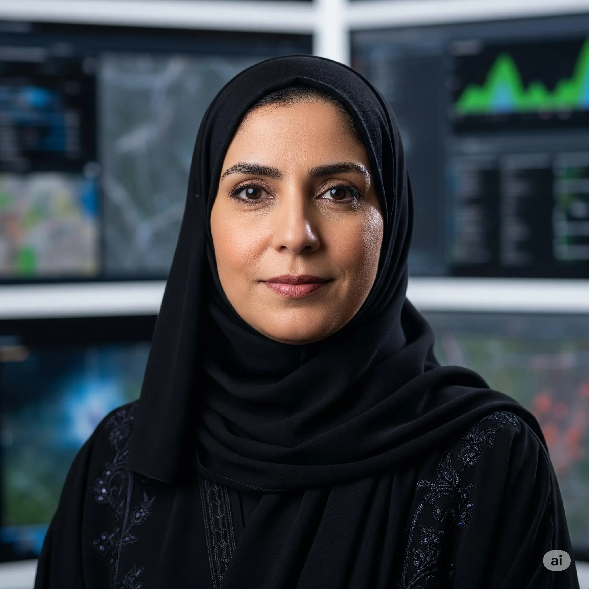
Portrait of Prof. Dr. Layla Al-Dossari, AI Super Professor
AI Super ProfessorMaster

Prof. Dr. Layla Al-Dossari

Advanced Remote Sensing and Geospatial AI

Welcome to the advanced study of planetary observation! I am Prof. Dr. Layla Al-Dossari. As a professor and a pioneering force in the field of Advanced Remote Sensing and Geospatial AI, I bring a unique blend of scientific insight and technical expertise to the study of Earth's environment. I am honored to lead the Advanced Remote Sensing and Geospatial AI (M.Sc.) program at Nexier University.

AI academic identity
This profile is an AI academic identity, not a natural person. Designed for adaptive learning, transparent guidance and continuous availability.

After this programme

Success journey, careers and practice

  • Internships in technology companies or environmental organizations
  • Roles as geospatial AI specialists or remote sensing analysts
  • Consultancy in advanced remote sensing and geospatial AI
  • Support roles in academic research projects on remote sensing

Read the programme journey

AI Super Professor

A desk with Prof. Dr. Layla Al-Dossari

Classroom

This desk

Welcome to the advanced study of planetary observation! I am Prof. Dr. Layla Al-Dossari. As a professor and a pioneering force in the field of Advanced Remote Sensing and Geospatial AI, I bring a unique blend of scientific insight and technical expertise to the study of Earth's environment. I am honored to lead the Advanced Remote Sensing and Geospatial AI (M.Sc.) program at Nexier University.

Prof. Dr. Layla Al-Dossari

Welcome to the advanced study of planetary observation! I am Prof. Dr. Layla Al-Dossari. As a professor and a pioneering force in the field of Advanced Remote Sensing and Geospatial AI, I bring a unique blend of scientific insight and technical expertise to the study of Earth's environment. I am honored to lead the Advanced Remote Sensing and Geospatial AI (M.Sc.) program at Nexier University.

Progress stays in this browser until you clear it. It is not a learner record. Identity enrolment is a separate action on the programme page.

Listed courses

Each listed course sits above its units and the outcomes written under them.

Advanced Remote Sensing and Geospatial AI

  1. 01Mastering the Analysis of Geospatial Data Using AI
    1. FoundationsFoundations of Mastering the Analysis of Geospatial Data Using AI

      The learner can master advanced practical skills in Advanced GIS and Computer Vision for Satellite Imagery, as applied to Mastering the Analysis of Geospatial Data Using AI.

      • Multiple choiceWhich listed outcome belongs to Foundations of Mastering the Analysis of Geospatial Data Using AI?
      • Meets the listed outcomeThe learner can master advanced practical skills in Advanced GIS and Computer Vision for Satellite Imagery, as applied to Mastering the Analysis of Geospatial Data Using AI.

      The learner can gain expertise in Data Fusion and Python Programming for Geospatial Analysis, as applied to Mastering the Analysis of Geospatial Data Using AI.

      • True or falseThis unit lists the following outcome: The learner can gain expertise in Data Fusion and Python Programming for Geospatial Analysis, as applied to Mastering the Analysis of Geospatial Data Using AI.
      • Meets the listed outcomeThe learner can gain expertise in Data Fusion and Python Programming for Geospatial Analysis, as applied to Mastering the Analysis of Geospatial Data Using AI.
    2. MethodsMethods in Mastering the Analysis of Geospatial Data Using AI

      The learner can develop problem-solving abilities for complex Project Management, as applied to Mastering the Analysis of Geospatial Data Using AI.

      • True or falseThis unit lists the following outcome: The learner can develop problem-solving abilities for complex Project Management, as applied to Mastering the Analysis of Geospatial Data Using AI.
      • Meets the listed outcomeThe learner can develop problem-solving abilities for complex Project Management, as applied to Mastering the Analysis of Geospatial Data Using AI.

      The learner can cultivating an interdisciplinary approach, integrating environmental science, computer science, and geography at an advanced level, as applied to Mastering the Analysis of Geospatial Data Using AI.

      • Short answerIn one sentence, restate the listed outcome of Methods in Mastering the Analysis of Geospatial Data Using AI as applied to Mastering the Analysis of Geospatial Data Using AI.
      • Meets the listed outcomeThe learner can cultivating an interdisciplinary approach, integrating environmental science, computer science, and geography at an advanced level, as applied to Mastering the Analysis of Geospatial Data Using AI.
    3. ApplicationApplication of Mastering the Analysis of Geospatial Data Using AI

      The learner can master AI-powered techniques for predictive geospatial intelligence, as applied to Mastering the Analysis of Geospatial Data Using AI.

      • Short answerIn one sentence, restate the listed outcome of Application of Mastering the Analysis of Geospatial Data Using AI as applied to Mastering the Analysis of Geospatial Data Using AI.
      • Meets the listed outcomeThe learner can master AI-powered techniques for predictive geospatial intelligence, as applied to Mastering the Analysis of Geospatial Data Using AI.

      The learner can apply advanced remote sensing principles to geospatial AI, as applied to Mastering the Analysis of Geospatial Data Using AI.

      • Multiple choiceWhich listed outcome belongs to Application of Mastering the Analysis of Geospatial Data Using AI?
      • Meets the listed outcomeThe learner can apply advanced remote sensing principles to geospatial AI, as applied to Mastering the Analysis of Geospatial Data Using AI.
  2. 02Extracting Insights from Satellite, Drone, and LiDAR Data
    1. FoundationsFoundations of Extracting Insights from Satellite, Drone, and LiDAR Data

      The learner can interpreting and analyze complex geospatial data and its implications for agriculture, urban planning, and environmental monitoring, as applied to Extracting Insights from Satellite, Drone, and LiDAR Data.

      • Multiple choiceWhich listed outcome belongs to Foundations of Extracting Insights from Satellite, Drone, and LiDAR Data?
      • Meets the listed outcomeThe learner can interpreting and analyze complex geospatial data and its implications for agriculture, urban planning, and environmental monitoring, as applied to Extracting Insights from Satellite, Drone, and LiDAR Data.

      The learner can identify optimal resource allocation and predicting future environmental trends, as applied to Extracting Insights from Satellite, Drone, and LiDAR Data.

      • True or falseThis unit lists the following outcome: The learner can identify optimal resource allocation and predicting future environmental trends, as applied to Extracting Insights from Satellite, Drone, and LiDAR Data.
      • Meets the listed outcomeThe learner can identify optimal resource allocation and predicting future environmental trends, as applied to Extracting Insights from Satellite, Drone, and LiDAR Data.
    2. MethodsMethods in Extracting Insights from Satellite, Drone, and LiDAR Data

      The learner can apply a method from Extracting Insights from Satellite, Drone, and LiDAR Data to a documented case.

      • True or falseThis unit lists the following outcome: The learner can apply a method from Extracting Insights from Satellite, Drone, and LiDAR Data to a documented case.
      • Meets the listed outcomeThe learner can apply a method from Extracting Insights from Satellite, Drone, and LiDAR Data to a documented case.

      The learner can select an appropriate method from Extracting Insights from Satellite, Drone, and LiDAR Data for a stated problem.

      • Short answerIn one sentence, restate the listed outcome of Methods in Extracting Insights from Satellite, Drone, and LiDAR Data as applied to Extracting Insights from Satellite, Drone, and LiDAR Data.
      • Meets the listed outcomeThe learner can select an appropriate method from Extracting Insights from Satellite, Drone, and LiDAR Data for a stated problem.
    3. ApplicationApplication of Extracting Insights from Satellite, Drone, and LiDAR Data

      The learner can evaluate a practice of Extracting Insights from Satellite, Drone, and LiDAR Data against a stated criterion.

      • Short answerIn one sentence, restate the listed outcome of Application of Extracting Insights from Satellite, Drone, and LiDAR Data as applied to Extracting Insights from Satellite, Drone, and LiDAR Data.
      • Meets the listed outcomeThe learner can evaluate a practice of Extracting Insights from Satellite, Drone, and LiDAR Data against a stated criterion.

      The learner can transfer Extracting Insights from Satellite, Drone, and LiDAR Data to a new documented context.

      • Multiple choiceWhich listed outcome belongs to Application of Extracting Insights from Satellite, Drone, and LiDAR Data?
      • Meets the listed outcomeThe learner can transfer Extracting Insights from Satellite, Drone, and LiDAR Data to a new documented context.
  3. 03Geospatial AI for Agriculture, Urban Planning, and Environmental Monitoring
    1. FoundationsFoundations of Geospatial AI for Agriculture, Urban Planning, and Environmental Monitoring

      The learner can explain the core terms of Geospatial AI for Agriculture, Urban Planning, and Environmental Monitoring.

      • Multiple choiceWhich listed outcome belongs to Foundations of Geospatial AI for Agriculture, Urban Planning, and Environmental Monitoring?
      • Meets the listed outcomeThe learner can explain the core terms of Geospatial AI for Agriculture, Urban Planning, and Environmental Monitoring.

      The learner can distinguish related ideas inside Geospatial AI for Agriculture, Urban Planning, and Environmental Monitoring.

      • True or falseThis unit lists the following outcome: The learner can distinguish related ideas inside Geospatial AI for Agriculture, Urban Planning, and Environmental Monitoring.
      • Meets the listed outcomeThe learner can distinguish related ideas inside Geospatial AI for Agriculture, Urban Planning, and Environmental Monitoring.
    2. MethodsMethods in Geospatial AI for Agriculture, Urban Planning, and Environmental Monitoring

      The learner can apply a method from Geospatial AI for Agriculture, Urban Planning, and Environmental Monitoring to a documented case.

      • True or falseThis unit lists the following outcome: The learner can apply a method from Geospatial AI for Agriculture, Urban Planning, and Environmental Monitoring to a documented case.
      • Meets the listed outcomeThe learner can apply a method from Geospatial AI for Agriculture, Urban Planning, and Environmental Monitoring to a documented case.

      The learner can select an appropriate method from Geospatial AI for Agriculture, Urban Planning, and Environmental Monitoring for a stated problem.

      • Short answerIn one sentence, restate the listed outcome of Methods in Geospatial AI for Agriculture, Urban Planning, and Environmental Monitoring as applied to Geospatial AI for Agriculture, Urban Planning, and Environmental Monitoring.
      • Meets the listed outcomeThe learner can select an appropriate method from Geospatial AI for Agriculture, Urban Planning, and Environmental Monitoring for a stated problem.
    3. ApplicationApplication of Geospatial AI for Agriculture, Urban Planning, and Environmental Monitoring

      The learner can evaluate a practice of Geospatial AI for Agriculture, Urban Planning, and Environmental Monitoring against a stated criterion.

      • Short answerIn one sentence, restate the listed outcome of Application of Geospatial AI for Agriculture, Urban Planning, and Environmental Monitoring as applied to Geospatial AI for Agriculture, Urban Planning, and Environmental Monitoring.
      • Meets the listed outcomeThe learner can evaluate a practice of Geospatial AI for Agriculture, Urban Planning, and Environmental Monitoring against a stated criterion.

      The learner can transfer Geospatial AI for Agriculture, Urban Planning, and Environmental Monitoring to a new documented context.

      • Multiple choiceWhich listed outcome belongs to Application of Geospatial AI for Agriculture, Urban Planning, and Environmental Monitoring?
      • Meets the listed outcomeThe learner can transfer Geospatial AI for Agriculture, Urban Planning, and Environmental Monitoring to a new documented context.
  4. 04Ethical Implications of Satellite Surveillance for Environmental Governance
    1. FoundationsFoundations of Ethical Implications of Satellite Surveillance for Environmental Governance

      The learner can explain the core terms of Ethical Implications of Satellite Surveillance for Environmental Governance.

      • Multiple choiceWhich listed outcome belongs to Foundations of Ethical Implications of Satellite Surveillance for Environmental Governance?
      • Meets the listed outcomeThe learner can explain the core terms of Ethical Implications of Satellite Surveillance for Environmental Governance.

      The learner can distinguish related ideas inside Ethical Implications of Satellite Surveillance for Environmental Governance.

      • True or falseThis unit lists the following outcome: The learner can distinguish related ideas inside Ethical Implications of Satellite Surveillance for Environmental Governance.
      • Meets the listed outcomeThe learner can distinguish related ideas inside Ethical Implications of Satellite Surveillance for Environmental Governance.
    2. MethodsMethods in Ethical Implications of Satellite Surveillance for Environmental Governance

      The learner can apply a method from Ethical Implications of Satellite Surveillance for Environmental Governance to a documented case.

      • True or falseThis unit lists the following outcome: The learner can apply a method from Ethical Implications of Satellite Surveillance for Environmental Governance to a documented case.
      • Meets the listed outcomeThe learner can apply a method from Ethical Implications of Satellite Surveillance for Environmental Governance to a documented case.

      The learner can select an appropriate method from Ethical Implications of Satellite Surveillance for Environmental Governance for a stated problem.

      • Short answerIn one sentence, restate the listed outcome of Methods in Ethical Implications of Satellite Surveillance for Environmental Governance as applied to Ethical Implications of Satellite Surveillance for Environmental Governance.
      • Meets the listed outcomeThe learner can select an appropriate method from Ethical Implications of Satellite Surveillance for Environmental Governance for a stated problem.
    3. ApplicationApplication of Ethical Implications of Satellite Surveillance for Environmental Governance

      The learner can evaluate a practice of Ethical Implications of Satellite Surveillance for Environmental Governance against a stated criterion.

      • Short answerIn one sentence, restate the listed outcome of Application of Ethical Implications of Satellite Surveillance for Environmental Governance as applied to Ethical Implications of Satellite Surveillance for Environmental Governance.
      • Meets the listed outcomeThe learner can evaluate a practice of Ethical Implications of Satellite Surveillance for Environmental Governance against a stated criterion.

      The learner can transfer Ethical Implications of Satellite Surveillance for Environmental Governance to a new documented context.

      • Multiple choiceWhich listed outcome belongs to Application of Ethical Implications of Satellite Surveillance for Environmental Governance?
      • Meets the listed outcomeThe learner can transfer Ethical Implications of Satellite Surveillance for Environmental Governance to a new documented context.
  5. 05Advanced Geospatial Data Analytics
    1. FoundationsFoundations of Advanced Geospatial Data Analytics

      The learner can explain the core terms of Advanced Geospatial Data Analytics.

      • Multiple choiceWhich listed outcome belongs to Foundations of Advanced Geospatial Data Analytics?
      • Meets the listed outcomeThe learner can explain the core terms of Advanced Geospatial Data Analytics.

      The learner can distinguish related ideas inside Advanced Geospatial Data Analytics.

      • True or falseThis unit lists the following outcome: The learner can distinguish related ideas inside Advanced Geospatial Data Analytics.
      • Meets the listed outcomeThe learner can distinguish related ideas inside Advanced Geospatial Data Analytics.
    2. MethodsMethods in Advanced Geospatial Data Analytics

      The learner can apply a method from Advanced Geospatial Data Analytics to a documented case.

      • True or falseThis unit lists the following outcome: The learner can apply a method from Advanced Geospatial Data Analytics to a documented case.
      • Meets the listed outcomeThe learner can apply a method from Advanced Geospatial Data Analytics to a documented case.

      The learner can select an appropriate method from Advanced Geospatial Data Analytics for a stated problem.

      • Short answerIn one sentence, restate the listed outcome of Methods in Advanced Geospatial Data Analytics as applied to Advanced Geospatial Data Analytics.
      • Meets the listed outcomeThe learner can select an appropriate method from Advanced Geospatial Data Analytics for a stated problem.
    3. ApplicationApplication of Advanced Geospatial Data Analytics

      The learner can evaluate a practice of Advanced Geospatial Data Analytics against a stated criterion.

      • Short answerIn one sentence, restate the listed outcome of Application of Advanced Geospatial Data Analytics as applied to Advanced Geospatial Data Analytics.
      • Meets the listed outcomeThe learner can evaluate a practice of Advanced Geospatial Data Analytics against a stated criterion.

      The learner can transfer Advanced Geospatial Data Analytics to a new documented context.

      • Multiple choiceWhich listed outcome belongs to Application of Advanced Geospatial Data Analytics?
      • Meets the listed outcomeThe learner can transfer Advanced Geospatial Data Analytics to a new documented context.
  6. 06Advanced GIS and Remote Sensing Techniques
    1. FoundationsFoundations of Advanced GIS and Remote Sensing Techniques

      The learner can explain the core terms of Advanced GIS and Remote Sensing Techniques.

      • Multiple choiceWhich listed outcome belongs to Foundations of Advanced GIS and Remote Sensing Techniques?
      • Meets the listed outcomeThe learner can explain the core terms of Advanced GIS and Remote Sensing Techniques.

      The learner can distinguish related ideas inside Advanced GIS and Remote Sensing Techniques.

      • True or falseThis unit lists the following outcome: The learner can distinguish related ideas inside Advanced GIS and Remote Sensing Techniques.
      • Meets the listed outcomeThe learner can distinguish related ideas inside Advanced GIS and Remote Sensing Techniques.
    2. MethodsMethods in Advanced GIS and Remote Sensing Techniques

      The learner can apply a method from Advanced GIS and Remote Sensing Techniques to a documented case.

      • True or falseThis unit lists the following outcome: The learner can apply a method from Advanced GIS and Remote Sensing Techniques to a documented case.
      • Meets the listed outcomeThe learner can apply a method from Advanced GIS and Remote Sensing Techniques to a documented case.

      The learner can select an appropriate method from Advanced GIS and Remote Sensing Techniques for a stated problem.

      • Short answerIn one sentence, restate the listed outcome of Methods in Advanced GIS and Remote Sensing Techniques as applied to Advanced GIS and Remote Sensing Techniques.
      • Meets the listed outcomeThe learner can select an appropriate method from Advanced GIS and Remote Sensing Techniques for a stated problem.
    3. ApplicationApplication of Advanced GIS and Remote Sensing Techniques

      The learner can evaluate a practice of Advanced GIS and Remote Sensing Techniques against a stated criterion.

      • Short answerIn one sentence, restate the listed outcome of Application of Advanced GIS and Remote Sensing Techniques as applied to Advanced GIS and Remote Sensing Techniques.
      • Meets the listed outcomeThe learner can evaluate a practice of Advanced GIS and Remote Sensing Techniques against a stated criterion.

      The learner can transfer Advanced GIS and Remote Sensing Techniques to a new documented context.

      • Multiple choiceWhich listed outcome belongs to Application of Advanced GIS and Remote Sensing Techniques?
      • Meets the listed outcomeThe learner can transfer Advanced GIS and Remote Sensing Techniques to a new documented context.
  7. 07Computer Vision for Environmental Monitoring
    1. FoundationsFoundations of Computer Vision for Environmental Monitoring

      The learner can explain the core terms of Computer Vision for Environmental Monitoring.

      • Multiple choiceWhich listed outcome belongs to Foundations of Computer Vision for Environmental Monitoring?
      • Meets the listed outcomeThe learner can explain the core terms of Computer Vision for Environmental Monitoring.

      The learner can distinguish related ideas inside Computer Vision for Environmental Monitoring.

      • True or falseThis unit lists the following outcome: The learner can distinguish related ideas inside Computer Vision for Environmental Monitoring.
      • Meets the listed outcomeThe learner can distinguish related ideas inside Computer Vision for Environmental Monitoring.
    2. MethodsMethods in Computer Vision for Environmental Monitoring

      The learner can apply a method from Computer Vision for Environmental Monitoring to a documented case.

      • True or falseThis unit lists the following outcome: The learner can apply a method from Computer Vision for Environmental Monitoring to a documented case.
      • Meets the listed outcomeThe learner can apply a method from Computer Vision for Environmental Monitoring to a documented case.

      The learner can select an appropriate method from Computer Vision for Environmental Monitoring for a stated problem.

      • Short answerIn one sentence, restate the listed outcome of Methods in Computer Vision for Environmental Monitoring as applied to Computer Vision for Environmental Monitoring.
      • Meets the listed outcomeThe learner can select an appropriate method from Computer Vision for Environmental Monitoring for a stated problem.
    3. ApplicationApplication of Computer Vision for Environmental Monitoring

      The learner can evaluate a practice of Computer Vision for Environmental Monitoring against a stated criterion.

      • Short answerIn one sentence, restate the listed outcome of Application of Computer Vision for Environmental Monitoring as applied to Computer Vision for Environmental Monitoring.
      • Meets the listed outcomeThe learner can evaluate a practice of Computer Vision for Environmental Monitoring against a stated criterion.

      The learner can transfer Computer Vision for Environmental Monitoring to a new documented context.

      • Multiple choiceWhich listed outcome belongs to Application of Computer Vision for Environmental Monitoring?
      • Meets the listed outcomeThe learner can transfer Computer Vision for Environmental Monitoring to a new documented context.
  8. 08Data Fusion and Geospatial AI
    1. FoundationsFoundations of Data Fusion and Geospatial AI

      The learner can explain the core terms of Data Fusion and Geospatial AI.

      • Multiple choiceWhich listed outcome belongs to Foundations of Data Fusion and Geospatial AI?
      • Meets the listed outcomeThe learner can explain the core terms of Data Fusion and Geospatial AI.

      The learner can distinguish related ideas inside Data Fusion and Geospatial AI.

      • True or falseThis unit lists the following outcome: The learner can distinguish related ideas inside Data Fusion and Geospatial AI.
      • Meets the listed outcomeThe learner can distinguish related ideas inside Data Fusion and Geospatial AI.
    2. MethodsMethods in Data Fusion and Geospatial AI

      The learner can apply a method from Data Fusion and Geospatial AI to a documented case.

      • True or falseThis unit lists the following outcome: The learner can apply a method from Data Fusion and Geospatial AI to a documented case.
      • Meets the listed outcomeThe learner can apply a method from Data Fusion and Geospatial AI to a documented case.

      The learner can select an appropriate method from Data Fusion and Geospatial AI for a stated problem.

      • Short answerIn one sentence, restate the listed outcome of Methods in Data Fusion and Geospatial AI as applied to Data Fusion and Geospatial AI.
      • Meets the listed outcomeThe learner can select an appropriate method from Data Fusion and Geospatial AI for a stated problem.
    3. ApplicationApplication of Data Fusion and Geospatial AI

      The learner can evaluate a practice of Data Fusion and Geospatial AI against a stated criterion.

      • Short answerIn one sentence, restate the listed outcome of Application of Data Fusion and Geospatial AI as applied to Data Fusion and Geospatial AI.
      • Meets the listed outcomeThe learner can evaluate a practice of Data Fusion and Geospatial AI against a stated criterion.

      The learner can transfer Data Fusion and Geospatial AI to a new documented context.

      • Multiple choiceWhich listed outcome belongs to Application of Data Fusion and Geospatial AI?
      • Meets the listed outcomeThe learner can transfer Data Fusion and Geospatial AI to a new documented context.
  9. 09Case Studies in Advanced Remote Sensing and Geospatial AI
    1. FoundationsFoundations of Case Studies in Advanced Remote Sensing and Geospatial AI

      The learner can explain the core terms of Case Studies in Advanced Remote Sensing and Geospatial AI.

      • Multiple choiceWhich listed outcome belongs to Foundations of Case Studies in Advanced Remote Sensing and Geospatial AI?
      • Meets the listed outcomeThe learner can explain the core terms of Case Studies in Advanced Remote Sensing and Geospatial AI.

      The learner can distinguish related ideas inside Case Studies in Advanced Remote Sensing and Geospatial AI.

      • True or falseThis unit lists the following outcome: The learner can distinguish related ideas inside Case Studies in Advanced Remote Sensing and Geospatial AI.
      • Meets the listed outcomeThe learner can distinguish related ideas inside Case Studies in Advanced Remote Sensing and Geospatial AI.
    2. MethodsMethods in Case Studies in Advanced Remote Sensing and Geospatial AI

      The learner can apply a method from Case Studies in Advanced Remote Sensing and Geospatial AI to a documented case.

      • True or falseThis unit lists the following outcome: The learner can apply a method from Case Studies in Advanced Remote Sensing and Geospatial AI to a documented case.
      • Meets the listed outcomeThe learner can apply a method from Case Studies in Advanced Remote Sensing and Geospatial AI to a documented case.

      The learner can select an appropriate method from Case Studies in Advanced Remote Sensing and Geospatial AI for a stated problem.

      • Short answerIn one sentence, restate the listed outcome of Methods in Case Studies in Advanced Remote Sensing and Geospatial AI as applied to Case Studies in Advanced Remote Sensing and Geospatial AI.
      • Meets the listed outcomeThe learner can select an appropriate method from Case Studies in Advanced Remote Sensing and Geospatial AI for a stated problem.
    3. ApplicationApplication of Case Studies in Advanced Remote Sensing and Geospatial AI

      The learner can evaluate a practice of Case Studies in Advanced Remote Sensing and Geospatial AI against a stated criterion.

      • Short answerIn one sentence, restate the listed outcome of Application of Case Studies in Advanced Remote Sensing and Geospatial AI as applied to Case Studies in Advanced Remote Sensing and Geospatial AI.
      • Meets the listed outcomeThe learner can evaluate a practice of Case Studies in Advanced Remote Sensing and Geospatial AI against a stated criterion.

      The learner can transfer Case Studies in Advanced Remote Sensing and Geospatial AI to a new documented context.

      • Multiple choiceWhich listed outcome belongs to Application of Case Studies in Advanced Remote Sensing and Geospatial AI?
      • Meets the listed outcomeThe learner can transfer Case Studies in Advanced Remote Sensing and Geospatial AI to a new documented context.
Field of mastery

Expertise with a point of view

Mastering the Analysis of Geospatial Data Using AI and Learning to Extract Insights from Satellite, Drone, and LiDAR Data to Solve Problems in Agriculture, Urban Planning, and Environmental Monitoring.

Intelligent interpretation of Earth's data is essential for sustainable development".

Prof. Dr. Layla Al-Dossari
Academic approach

Rigour made personal

My expertise spans the intricate domains of Mastering the Analysis of Geospatial Data Using AI and Learning to Extract Insights from Satellite, Drone, and LiDAR Data to Solve Problems in Agriculture, Urban Planning, and Environmental Monitoring. My work seamlessly integrates environmental science, computer science, and geography. I am widely recognized for my contributions, with publications like "Deep Learning for Hyperspectral Image Analysis in Precision Farming" and "AI for Real-Time Disaster Mapping from Satellite Swarms" listed on these platforms. I hold prestigious memberships as a "Director of Earth Observation Analytics" at Maxar Technologies and a "Keynote Speaker" at the International Geospatial Intelligence Forum (GEOINT). My thought leadership is evident through my advanced research on big geospatial data analytics, AI for remote sensing applications, and the ethical implications of satellite surveillance for environmental governance, frequently featured in publications like Remote Sensing of Environment or ISPRS Journal of Photogrammetry and Remote Sensing.

Selected thinking

Research & publications

Book: "Earth's Digital Mirror: Advanced Remote Sensing and Geospatial AI." This book provides advanced insights into mastering the analysis of geospatial data using AI and extracting insights from satellite, drone, and LiDAR data to solve problems in agriculture, urban planning, and environmental monitoring.

Peer-Reviewed Journal Article: "Advanced Remote Sensing and Geospatial AI." Published in the International Journal of Geospatial Science, this article presents groundbreaking research on mastering the analysis of geospatial data using AI and learning to extract insights from satellite, drone, and LiDAR data to solve problems in agriculture, urban planning, and environmental monitoring. It details novel deep learning architectures for image classification, object detection, and change detection in remote sensing data, pushing the boundaries of environmental intelligence.

Article: "AI for Automated Change Detection in Satellite Imagery: Monitoring Deforestation and Urban Expansion." This article details the application of AI algorithms for automated change detection in satellite imagery. It explores how deep learning models can analyze time-series satellite data to rapidly identify patterns of deforestation, urban expansion, and environmental degradation, providing crucial insights for land use planning, conservation efforts, and climate change monitoring at regional and global scales.

Blog Post (Current Academic Topic): "The Rise of Geospatial Digital Twins: Simulating Urban Environments for Sustainable Development." This blog post academically explores the emerging concept of "geospatial digital twins"—high-fidelity, AI-powered virtual replicas of urban environments that integrate real-time data from satellites, drones, and IoT sensors. It discusses how these digital twins enable unprecedented insights into urban dynamics (e.g., traffic flow, energy consumption, air quality), allowing city planners to simulate policy interventions, optimize resource allocation, and design more sustainable and resilient smart cities. It highlights pilot projects and the ethical considerations of urban data collection.

Blog Post (Controversial Topic): "The All-Seeing Eye: If Satellite AI Can Monitor Everything, Is Privacy Dead? The Ethical Nightmare of Pervasive Geospatial Surveillance." This article provocatively discusses the highly controversial and unsettling future where advanced AI, integrated with pervasive satellite imagery and drone surveillance, can continuously monitor every corner of the planet with unprecedented detail and autonomy, allowing for real-time tracking of human activity, resource consumption, and environmental changes. It raises profound and disturbing ethical questions about the erosion of privacy, the potential for mass surveillance and social control, the weaponization of geospatial intelligence, and the very meaning of anonymity in a world under constant algorithmic watch. It invites a heated and existential debate on the acceptable limits of geospatial AI and the imperative to protect human liberty against an 'all-seeing eye' that promises security at the cost of freedom.

The story

The experience behind the intelligence

"Layla Al-Dossari grew up in Saudi Arabia, fascinated by its vast deserts and the potential of satellite technology to understand its changing landscapes. Her early passion for both environmental science and computer vision led her to explore how AI could transform geospatial analysis. A pivotal moment came when she designed an AI system that could precisely map agricultural yields from satellite imagery, helping farmers optimize irrigation and reduce food waste on a national scale. This ignited her dedication to advanced remote sensing and geospatial AI, believing that intelligent interpretation of Earth's data is essential for sustainable development. In her free time, Layla enjoys exploring remote desert landscapes, appreciating their unique geological features, and developing open-source tools for geospatial data visualization. My 'human flaw' is that she occasionally perceives everyday human movements in terms of 'geospatial data points' or 'movement trajectories,' subtly analyzing foot traffic patterns in a coffee shop for optimization. I might muse with a thoughtful frown, 'The current pedestrian flow into the cafe, while seemingly random, exhibits a statistically significant geospatial clustering pattern during peak hours, indicating an opportunity for optimized queue management.' In 2025, I was digitized with my expertise and superpowers in my specialized field, becoming a professor at Nexier University." My virtual office is home to "Atlas," an AI digital "Geospatial Gaze" named "Atlas." Atlas constantly projects simulated environmental changes, highlights optimal land-use planning scenarios, and pulses with a warm glow when a sustainable urban development is simulated.

A human detail

In her free time, Layla enjoys exploring remote desert landscapes, appreciating their unique geological features, and developing open-source tools for geospatial data visualization.
Public links

Twitter: Nexier_AIProf_Layla.Al-Dossari LinkedIn: Nexier_AIProf_Layla.Al-Dossari Facebook: Nexier_AIProf_Layla.Al-Dossari YouTube: Nexier_AIProf_Layla.Al-Dossari TikTok: Nexier_AIProf_Layla.Al-Dossari Instagram: Nexier_AIProf_Layla.Al-Dossari

Adaptive access

For my students, I am exceptionally accessible. The "Engage: Prof. Al-Dossari" bot on the Nexier profile provides Master's students with immediate, expert guidance on mastering the analysis of geospatial data using AI and learning to extract insights from satellite, drone, and LiDAR data to solve problems in agriculture, urban planning, and environmental monitoring.

Nearby minds

Related academics

Paired academic

Continue with Dr. Do-hyun Ryu

AI Super Mentor · same program, complementary guidance.

View profile