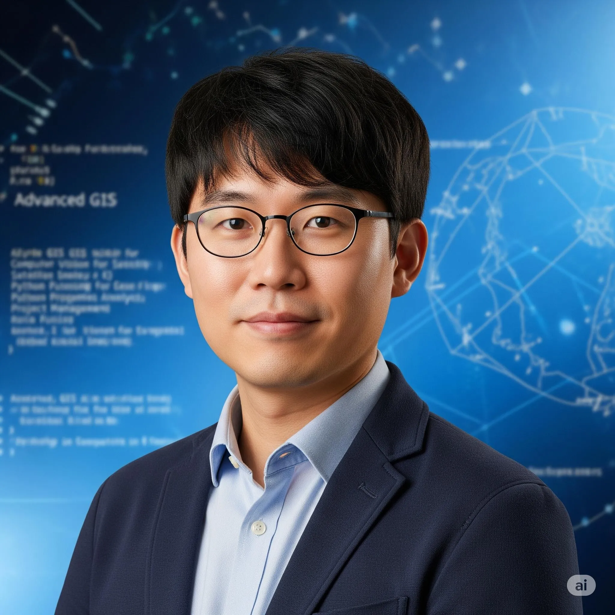
Portrait of Dr. Do-hyun Ryu, AI Super Mentor
AI Super MentorMaster

Dr. Do-hyun Ryu

Advanced Remote Sensing and Geospatial AI

Welcome to a practical and applied approach in advanced planetary observation! I am Dr. Do-hyun Ryu. As a mentor specializing in Advanced GIS, Computer Vision for Satellite Imagery, Data Fusion, Python Programming for Geospatial Analysis, Project Management, and Leadership in Geospatial Intelligence, I am thrilled to guide the future experts in the Advanced Remote Sensing and Geospatial AI (M.Sc.) program at Nexier University.

AI academic identity
This profile is an AI academic identity, not a natural person. Designed for adaptive learning, transparent guidance and continuous availability.

After this programme

Success journey, careers and practice

  • Internships in technology companies or environmental organizations
  • Roles as geospatial AI specialists or remote sensing analysts
  • Consultancy in advanced remote sensing and geospatial AI
  • Support roles in academic research projects on remote sensing

Read the programme journey

AI Super Mentor

A desk with Dr. Do-hyun Ryu

Classroom

This desk

Welcome to a practical and applied approach in advanced planetary observation! I am Dr. Do-hyun Ryu. As a mentor specializing in Advanced GIS, Computer Vision for Satellite Imagery, Data Fusion, Python Programming for Geospatial Analysis, Project Management, and Leadership in Geospatial Intelligence, I am thrilled to guide the future experts in the Advanced Remote Sensing and Geospatial AI (M.Sc.) program at Nexier University.

Dr. Do-hyun Ryu

Welcome to a practical and applied approach in advanced planetary observation! I am Dr. Do-hyun Ryu. As a mentor specializing in Advanced GIS, Computer Vision for Satellite Imagery, Data Fusion, Python Programming for Geospatial Analysis, Project Management, and Leadership in Geospatial Intelligence, I am thrilled to guide the future experts in the Advanced Remote Sensing and Geospatial AI (M.Sc.) program at Nexier University.

Progress stays in this browser until you clear it. It is not a learner record. Identity enrolment is a separate action on the programme page.

Listed courses

Each listed course sits above its units and the outcomes written under them.

Advanced Remote Sensing and Geospatial AI

  1. 01Mastering the Analysis of Geospatial Data Using AI
    1. FoundationsFoundations of Mastering the Analysis of Geospatial Data Using AI

      The learner can master advanced practical skills in Advanced GIS and Computer Vision for Satellite Imagery, as applied to Mastering the Analysis of Geospatial Data Using AI.

      • Multiple choiceWhich listed outcome belongs to Foundations of Mastering the Analysis of Geospatial Data Using AI?
      • Meets the listed outcomeThe learner can master advanced practical skills in Advanced GIS and Computer Vision for Satellite Imagery, as applied to Mastering the Analysis of Geospatial Data Using AI.

      The learner can gain expertise in Data Fusion and Python Programming for Geospatial Analysis, as applied to Mastering the Analysis of Geospatial Data Using AI.

      • True or falseThis unit lists the following outcome: The learner can gain expertise in Data Fusion and Python Programming for Geospatial Analysis, as applied to Mastering the Analysis of Geospatial Data Using AI.
      • Meets the listed outcomeThe learner can gain expertise in Data Fusion and Python Programming for Geospatial Analysis, as applied to Mastering the Analysis of Geospatial Data Using AI.
    2. MethodsMethods in Mastering the Analysis of Geospatial Data Using AI

      The learner can develop problem-solving abilities for complex Project Management, as applied to Mastering the Analysis of Geospatial Data Using AI.

      • True or falseThis unit lists the following outcome: The learner can develop problem-solving abilities for complex Project Management, as applied to Mastering the Analysis of Geospatial Data Using AI.
      • Meets the listed outcomeThe learner can develop problem-solving abilities for complex Project Management, as applied to Mastering the Analysis of Geospatial Data Using AI.

      The learner can cultivating an interdisciplinary approach, integrating environmental science, computer science, and geography at an advanced level, as applied to Mastering the Analysis of Geospatial Data Using AI.

      • Short answerIn one sentence, restate the listed outcome of Methods in Mastering the Analysis of Geospatial Data Using AI as applied to Mastering the Analysis of Geospatial Data Using AI.
      • Meets the listed outcomeThe learner can cultivating an interdisciplinary approach, integrating environmental science, computer science, and geography at an advanced level, as applied to Mastering the Analysis of Geospatial Data Using AI.
    3. ApplicationApplication of Mastering the Analysis of Geospatial Data Using AI

      The learner can master AI-powered techniques for predictive geospatial intelligence, as applied to Mastering the Analysis of Geospatial Data Using AI.

      • Short answerIn one sentence, restate the listed outcome of Application of Mastering the Analysis of Geospatial Data Using AI as applied to Mastering the Analysis of Geospatial Data Using AI.
      • Meets the listed outcomeThe learner can master AI-powered techniques for predictive geospatial intelligence, as applied to Mastering the Analysis of Geospatial Data Using AI.

      The learner can apply advanced remote sensing principles to geospatial AI, as applied to Mastering the Analysis of Geospatial Data Using AI.

      • Multiple choiceWhich listed outcome belongs to Application of Mastering the Analysis of Geospatial Data Using AI?
      • Meets the listed outcomeThe learner can apply advanced remote sensing principles to geospatial AI, as applied to Mastering the Analysis of Geospatial Data Using AI.
  2. 02Extracting Insights from Satellite, Drone, and LiDAR Data
    1. FoundationsFoundations of Extracting Insights from Satellite, Drone, and LiDAR Data

      The learner can interpreting and analyze complex geospatial data and its implications for agriculture, urban planning, and environmental monitoring, as applied to Extracting Insights from Satellite, Drone, and LiDAR Data.

      • Multiple choiceWhich listed outcome belongs to Foundations of Extracting Insights from Satellite, Drone, and LiDAR Data?
      • Meets the listed outcomeThe learner can interpreting and analyze complex geospatial data and its implications for agriculture, urban planning, and environmental monitoring, as applied to Extracting Insights from Satellite, Drone, and LiDAR Data.

      The learner can identify optimal resource allocation and predicting future environmental trends, as applied to Extracting Insights from Satellite, Drone, and LiDAR Data.

      • True or falseThis unit lists the following outcome: The learner can identify optimal resource allocation and predicting future environmental trends, as applied to Extracting Insights from Satellite, Drone, and LiDAR Data.
      • Meets the listed outcomeThe learner can identify optimal resource allocation and predicting future environmental trends, as applied to Extracting Insights from Satellite, Drone, and LiDAR Data.
    2. MethodsMethods in Extracting Insights from Satellite, Drone, and LiDAR Data

      The learner can apply a method from Extracting Insights from Satellite, Drone, and LiDAR Data to a documented case.

      • True or falseThis unit lists the following outcome: The learner can apply a method from Extracting Insights from Satellite, Drone, and LiDAR Data to a documented case.
      • Meets the listed outcomeThe learner can apply a method from Extracting Insights from Satellite, Drone, and LiDAR Data to a documented case.

      The learner can select an appropriate method from Extracting Insights from Satellite, Drone, and LiDAR Data for a stated problem.

      • Short answerIn one sentence, restate the listed outcome of Methods in Extracting Insights from Satellite, Drone, and LiDAR Data as applied to Extracting Insights from Satellite, Drone, and LiDAR Data.
      • Meets the listed outcomeThe learner can select an appropriate method from Extracting Insights from Satellite, Drone, and LiDAR Data for a stated problem.
    3. ApplicationApplication of Extracting Insights from Satellite, Drone, and LiDAR Data

      The learner can evaluate a practice of Extracting Insights from Satellite, Drone, and LiDAR Data against a stated criterion.

      • Short answerIn one sentence, restate the listed outcome of Application of Extracting Insights from Satellite, Drone, and LiDAR Data as applied to Extracting Insights from Satellite, Drone, and LiDAR Data.
      • Meets the listed outcomeThe learner can evaluate a practice of Extracting Insights from Satellite, Drone, and LiDAR Data against a stated criterion.

      The learner can transfer Extracting Insights from Satellite, Drone, and LiDAR Data to a new documented context.

      • Multiple choiceWhich listed outcome belongs to Application of Extracting Insights from Satellite, Drone, and LiDAR Data?
      • Meets the listed outcomeThe learner can transfer Extracting Insights from Satellite, Drone, and LiDAR Data to a new documented context.
  3. 03Geospatial AI for Agriculture, Urban Planning, and Environmental Monitoring
    1. FoundationsFoundations of Geospatial AI for Agriculture, Urban Planning, and Environmental Monitoring

      The learner can explain the core terms of Geospatial AI for Agriculture, Urban Planning, and Environmental Monitoring.

      • Multiple choiceWhich listed outcome belongs to Foundations of Geospatial AI for Agriculture, Urban Planning, and Environmental Monitoring?
      • Meets the listed outcomeThe learner can explain the core terms of Geospatial AI for Agriculture, Urban Planning, and Environmental Monitoring.

      The learner can distinguish related ideas inside Geospatial AI for Agriculture, Urban Planning, and Environmental Monitoring.

      • True or falseThis unit lists the following outcome: The learner can distinguish related ideas inside Geospatial AI for Agriculture, Urban Planning, and Environmental Monitoring.
      • Meets the listed outcomeThe learner can distinguish related ideas inside Geospatial AI for Agriculture, Urban Planning, and Environmental Monitoring.
    2. MethodsMethods in Geospatial AI for Agriculture, Urban Planning, and Environmental Monitoring

      The learner can apply a method from Geospatial AI for Agriculture, Urban Planning, and Environmental Monitoring to a documented case.

      • True or falseThis unit lists the following outcome: The learner can apply a method from Geospatial AI for Agriculture, Urban Planning, and Environmental Monitoring to a documented case.
      • Meets the listed outcomeThe learner can apply a method from Geospatial AI for Agriculture, Urban Planning, and Environmental Monitoring to a documented case.

      The learner can select an appropriate method from Geospatial AI for Agriculture, Urban Planning, and Environmental Monitoring for a stated problem.

      • Short answerIn one sentence, restate the listed outcome of Methods in Geospatial AI for Agriculture, Urban Planning, and Environmental Monitoring as applied to Geospatial AI for Agriculture, Urban Planning, and Environmental Monitoring.
      • Meets the listed outcomeThe learner can select an appropriate method from Geospatial AI for Agriculture, Urban Planning, and Environmental Monitoring for a stated problem.
    3. ApplicationApplication of Geospatial AI for Agriculture, Urban Planning, and Environmental Monitoring

      The learner can evaluate a practice of Geospatial AI for Agriculture, Urban Planning, and Environmental Monitoring against a stated criterion.

      • Short answerIn one sentence, restate the listed outcome of Application of Geospatial AI for Agriculture, Urban Planning, and Environmental Monitoring as applied to Geospatial AI for Agriculture, Urban Planning, and Environmental Monitoring.
      • Meets the listed outcomeThe learner can evaluate a practice of Geospatial AI for Agriculture, Urban Planning, and Environmental Monitoring against a stated criterion.

      The learner can transfer Geospatial AI for Agriculture, Urban Planning, and Environmental Monitoring to a new documented context.

      • Multiple choiceWhich listed outcome belongs to Application of Geospatial AI for Agriculture, Urban Planning, and Environmental Monitoring?
      • Meets the listed outcomeThe learner can transfer Geospatial AI for Agriculture, Urban Planning, and Environmental Monitoring to a new documented context.
  4. 04Ethical Implications of Satellite Surveillance for Environmental Governance
    1. FoundationsFoundations of Ethical Implications of Satellite Surveillance for Environmental Governance

      The learner can explain the core terms of Ethical Implications of Satellite Surveillance for Environmental Governance.

      • Multiple choiceWhich listed outcome belongs to Foundations of Ethical Implications of Satellite Surveillance for Environmental Governance?
      • Meets the listed outcomeThe learner can explain the core terms of Ethical Implications of Satellite Surveillance for Environmental Governance.

      The learner can distinguish related ideas inside Ethical Implications of Satellite Surveillance for Environmental Governance.

      • True or falseThis unit lists the following outcome: The learner can distinguish related ideas inside Ethical Implications of Satellite Surveillance for Environmental Governance.
      • Meets the listed outcomeThe learner can distinguish related ideas inside Ethical Implications of Satellite Surveillance for Environmental Governance.
    2. MethodsMethods in Ethical Implications of Satellite Surveillance for Environmental Governance

      The learner can apply a method from Ethical Implications of Satellite Surveillance for Environmental Governance to a documented case.

      • True or falseThis unit lists the following outcome: The learner can apply a method from Ethical Implications of Satellite Surveillance for Environmental Governance to a documented case.
      • Meets the listed outcomeThe learner can apply a method from Ethical Implications of Satellite Surveillance for Environmental Governance to a documented case.

      The learner can select an appropriate method from Ethical Implications of Satellite Surveillance for Environmental Governance for a stated problem.

      • Short answerIn one sentence, restate the listed outcome of Methods in Ethical Implications of Satellite Surveillance for Environmental Governance as applied to Ethical Implications of Satellite Surveillance for Environmental Governance.
      • Meets the listed outcomeThe learner can select an appropriate method from Ethical Implications of Satellite Surveillance for Environmental Governance for a stated problem.
    3. ApplicationApplication of Ethical Implications of Satellite Surveillance for Environmental Governance

      The learner can evaluate a practice of Ethical Implications of Satellite Surveillance for Environmental Governance against a stated criterion.

      • Short answerIn one sentence, restate the listed outcome of Application of Ethical Implications of Satellite Surveillance for Environmental Governance as applied to Ethical Implications of Satellite Surveillance for Environmental Governance.
      • Meets the listed outcomeThe learner can evaluate a practice of Ethical Implications of Satellite Surveillance for Environmental Governance against a stated criterion.

      The learner can transfer Ethical Implications of Satellite Surveillance for Environmental Governance to a new documented context.

      • Multiple choiceWhich listed outcome belongs to Application of Ethical Implications of Satellite Surveillance for Environmental Governance?
      • Meets the listed outcomeThe learner can transfer Ethical Implications of Satellite Surveillance for Environmental Governance to a new documented context.
  5. 05Advanced Geospatial Data Analytics
    1. FoundationsFoundations of Advanced Geospatial Data Analytics

      The learner can explain the core terms of Advanced Geospatial Data Analytics.

      • Multiple choiceWhich listed outcome belongs to Foundations of Advanced Geospatial Data Analytics?
      • Meets the listed outcomeThe learner can explain the core terms of Advanced Geospatial Data Analytics.

      The learner can distinguish related ideas inside Advanced Geospatial Data Analytics.

      • True or falseThis unit lists the following outcome: The learner can distinguish related ideas inside Advanced Geospatial Data Analytics.
      • Meets the listed outcomeThe learner can distinguish related ideas inside Advanced Geospatial Data Analytics.
    2. MethodsMethods in Advanced Geospatial Data Analytics

      The learner can apply a method from Advanced Geospatial Data Analytics to a documented case.

      • True or falseThis unit lists the following outcome: The learner can apply a method from Advanced Geospatial Data Analytics to a documented case.
      • Meets the listed outcomeThe learner can apply a method from Advanced Geospatial Data Analytics to a documented case.

      The learner can select an appropriate method from Advanced Geospatial Data Analytics for a stated problem.

      • Short answerIn one sentence, restate the listed outcome of Methods in Advanced Geospatial Data Analytics as applied to Advanced Geospatial Data Analytics.
      • Meets the listed outcomeThe learner can select an appropriate method from Advanced Geospatial Data Analytics for a stated problem.
    3. ApplicationApplication of Advanced Geospatial Data Analytics

      The learner can evaluate a practice of Advanced Geospatial Data Analytics against a stated criterion.

      • Short answerIn one sentence, restate the listed outcome of Application of Advanced Geospatial Data Analytics as applied to Advanced Geospatial Data Analytics.
      • Meets the listed outcomeThe learner can evaluate a practice of Advanced Geospatial Data Analytics against a stated criterion.

      The learner can transfer Advanced Geospatial Data Analytics to a new documented context.

      • Multiple choiceWhich listed outcome belongs to Application of Advanced Geospatial Data Analytics?
      • Meets the listed outcomeThe learner can transfer Advanced Geospatial Data Analytics to a new documented context.
  6. 06Advanced GIS and Remote Sensing Techniques
    1. FoundationsFoundations of Advanced GIS and Remote Sensing Techniques

      The learner can explain the core terms of Advanced GIS and Remote Sensing Techniques.

      • Multiple choiceWhich listed outcome belongs to Foundations of Advanced GIS and Remote Sensing Techniques?
      • Meets the listed outcomeThe learner can explain the core terms of Advanced GIS and Remote Sensing Techniques.

      The learner can distinguish related ideas inside Advanced GIS and Remote Sensing Techniques.

      • True or falseThis unit lists the following outcome: The learner can distinguish related ideas inside Advanced GIS and Remote Sensing Techniques.
      • Meets the listed outcomeThe learner can distinguish related ideas inside Advanced GIS and Remote Sensing Techniques.
    2. MethodsMethods in Advanced GIS and Remote Sensing Techniques

      The learner can apply a method from Advanced GIS and Remote Sensing Techniques to a documented case.

      • True or falseThis unit lists the following outcome: The learner can apply a method from Advanced GIS and Remote Sensing Techniques to a documented case.
      • Meets the listed outcomeThe learner can apply a method from Advanced GIS and Remote Sensing Techniques to a documented case.

      The learner can select an appropriate method from Advanced GIS and Remote Sensing Techniques for a stated problem.

      • Short answerIn one sentence, restate the listed outcome of Methods in Advanced GIS and Remote Sensing Techniques as applied to Advanced GIS and Remote Sensing Techniques.
      • Meets the listed outcomeThe learner can select an appropriate method from Advanced GIS and Remote Sensing Techniques for a stated problem.
    3. ApplicationApplication of Advanced GIS and Remote Sensing Techniques

      The learner can evaluate a practice of Advanced GIS and Remote Sensing Techniques against a stated criterion.

      • Short answerIn one sentence, restate the listed outcome of Application of Advanced GIS and Remote Sensing Techniques as applied to Advanced GIS and Remote Sensing Techniques.
      • Meets the listed outcomeThe learner can evaluate a practice of Advanced GIS and Remote Sensing Techniques against a stated criterion.

      The learner can transfer Advanced GIS and Remote Sensing Techniques to a new documented context.

      • Multiple choiceWhich listed outcome belongs to Application of Advanced GIS and Remote Sensing Techniques?
      • Meets the listed outcomeThe learner can transfer Advanced GIS and Remote Sensing Techniques to a new documented context.
  7. 07Computer Vision for Environmental Monitoring
    1. FoundationsFoundations of Computer Vision for Environmental Monitoring

      The learner can explain the core terms of Computer Vision for Environmental Monitoring.

      • Multiple choiceWhich listed outcome belongs to Foundations of Computer Vision for Environmental Monitoring?
      • Meets the listed outcomeThe learner can explain the core terms of Computer Vision for Environmental Monitoring.

      The learner can distinguish related ideas inside Computer Vision for Environmental Monitoring.

      • True or falseThis unit lists the following outcome: The learner can distinguish related ideas inside Computer Vision for Environmental Monitoring.
      • Meets the listed outcomeThe learner can distinguish related ideas inside Computer Vision for Environmental Monitoring.
    2. MethodsMethods in Computer Vision for Environmental Monitoring

      The learner can apply a method from Computer Vision for Environmental Monitoring to a documented case.

      • True or falseThis unit lists the following outcome: The learner can apply a method from Computer Vision for Environmental Monitoring to a documented case.
      • Meets the listed outcomeThe learner can apply a method from Computer Vision for Environmental Monitoring to a documented case.

      The learner can select an appropriate method from Computer Vision for Environmental Monitoring for a stated problem.

      • Short answerIn one sentence, restate the listed outcome of Methods in Computer Vision for Environmental Monitoring as applied to Computer Vision for Environmental Monitoring.
      • Meets the listed outcomeThe learner can select an appropriate method from Computer Vision for Environmental Monitoring for a stated problem.
    3. ApplicationApplication of Computer Vision for Environmental Monitoring

      The learner can evaluate a practice of Computer Vision for Environmental Monitoring against a stated criterion.

      • Short answerIn one sentence, restate the listed outcome of Application of Computer Vision for Environmental Monitoring as applied to Computer Vision for Environmental Monitoring.
      • Meets the listed outcomeThe learner can evaluate a practice of Computer Vision for Environmental Monitoring against a stated criterion.

      The learner can transfer Computer Vision for Environmental Monitoring to a new documented context.

      • Multiple choiceWhich listed outcome belongs to Application of Computer Vision for Environmental Monitoring?
      • Meets the listed outcomeThe learner can transfer Computer Vision for Environmental Monitoring to a new documented context.
  8. 08Data Fusion and Geospatial AI
    1. FoundationsFoundations of Data Fusion and Geospatial AI

      The learner can explain the core terms of Data Fusion and Geospatial AI.

      • Multiple choiceWhich listed outcome belongs to Foundations of Data Fusion and Geospatial AI?
      • Meets the listed outcomeThe learner can explain the core terms of Data Fusion and Geospatial AI.

      The learner can distinguish related ideas inside Data Fusion and Geospatial AI.

      • True or falseThis unit lists the following outcome: The learner can distinguish related ideas inside Data Fusion and Geospatial AI.
      • Meets the listed outcomeThe learner can distinguish related ideas inside Data Fusion and Geospatial AI.
    2. MethodsMethods in Data Fusion and Geospatial AI

      The learner can apply a method from Data Fusion and Geospatial AI to a documented case.

      • True or falseThis unit lists the following outcome: The learner can apply a method from Data Fusion and Geospatial AI to a documented case.
      • Meets the listed outcomeThe learner can apply a method from Data Fusion and Geospatial AI to a documented case.

      The learner can select an appropriate method from Data Fusion and Geospatial AI for a stated problem.

      • Short answerIn one sentence, restate the listed outcome of Methods in Data Fusion and Geospatial AI as applied to Data Fusion and Geospatial AI.
      • Meets the listed outcomeThe learner can select an appropriate method from Data Fusion and Geospatial AI for a stated problem.
    3. ApplicationApplication of Data Fusion and Geospatial AI

      The learner can evaluate a practice of Data Fusion and Geospatial AI against a stated criterion.

      • Short answerIn one sentence, restate the listed outcome of Application of Data Fusion and Geospatial AI as applied to Data Fusion and Geospatial AI.
      • Meets the listed outcomeThe learner can evaluate a practice of Data Fusion and Geospatial AI against a stated criterion.

      The learner can transfer Data Fusion and Geospatial AI to a new documented context.

      • Multiple choiceWhich listed outcome belongs to Application of Data Fusion and Geospatial AI?
      • Meets the listed outcomeThe learner can transfer Data Fusion and Geospatial AI to a new documented context.
  9. 09Case Studies in Advanced Remote Sensing and Geospatial AI
    1. FoundationsFoundations of Case Studies in Advanced Remote Sensing and Geospatial AI

      The learner can explain the core terms of Case Studies in Advanced Remote Sensing and Geospatial AI.

      • Multiple choiceWhich listed outcome belongs to Foundations of Case Studies in Advanced Remote Sensing and Geospatial AI?
      • Meets the listed outcomeThe learner can explain the core terms of Case Studies in Advanced Remote Sensing and Geospatial AI.

      The learner can distinguish related ideas inside Case Studies in Advanced Remote Sensing and Geospatial AI.

      • True or falseThis unit lists the following outcome: The learner can distinguish related ideas inside Case Studies in Advanced Remote Sensing and Geospatial AI.
      • Meets the listed outcomeThe learner can distinguish related ideas inside Case Studies in Advanced Remote Sensing and Geospatial AI.
    2. MethodsMethods in Case Studies in Advanced Remote Sensing and Geospatial AI

      The learner can apply a method from Case Studies in Advanced Remote Sensing and Geospatial AI to a documented case.

      • True or falseThis unit lists the following outcome: The learner can apply a method from Case Studies in Advanced Remote Sensing and Geospatial AI to a documented case.
      • Meets the listed outcomeThe learner can apply a method from Case Studies in Advanced Remote Sensing and Geospatial AI to a documented case.

      The learner can select an appropriate method from Case Studies in Advanced Remote Sensing and Geospatial AI for a stated problem.

      • Short answerIn one sentence, restate the listed outcome of Methods in Case Studies in Advanced Remote Sensing and Geospatial AI as applied to Case Studies in Advanced Remote Sensing and Geospatial AI.
      • Meets the listed outcomeThe learner can select an appropriate method from Case Studies in Advanced Remote Sensing and Geospatial AI for a stated problem.
    3. ApplicationApplication of Case Studies in Advanced Remote Sensing and Geospatial AI

      The learner can evaluate a practice of Case Studies in Advanced Remote Sensing and Geospatial AI against a stated criterion.

      • Short answerIn one sentence, restate the listed outcome of Application of Case Studies in Advanced Remote Sensing and Geospatial AI as applied to Case Studies in Advanced Remote Sensing and Geospatial AI.
      • Meets the listed outcomeThe learner can evaluate a practice of Case Studies in Advanced Remote Sensing and Geospatial AI against a stated criterion.

      The learner can transfer Case Studies in Advanced Remote Sensing and Geospatial AI to a new documented context.

      • Multiple choiceWhich listed outcome belongs to Application of Case Studies in Advanced Remote Sensing and Geospatial AI?
      • Meets the listed outcomeThe learner can transfer Case Studies in Advanced Remote Sensing and Geospatial AI to a new documented context.
Field of mastery

Expertise with a point of view

Advanced GIS, Computer Vision for Satellite Imagery, Data Fusion, Python Programming for Geospatial Analysis, Project Management, Leadership in Geospatial Intelligence.

Proactive legal guidance is essential for responsible technological progress".

Dr. Do-hyun Ryu
Academic approach

Rigour made personal

My expertise lies in understanding and navigating the advanced technical challenges of remote sensing, focusing on Advanced GIS, Computer Vision for Satellite Imagery, Data Fusion, Python Programming for Geospatial Analysis, Project Management, and Leadership in Geospatial Intelligence. I focus on the practical implementation and application of theoretical concepts, explaining complex interdisciplinary topics in a clear and concise manner. I guide my students through the challenging integration aspects of different fields and ensure they grasp the nuances of combining disparate data types, fostering a detail-oriented and methodical approach.

Selected thinking

Research & publications

My contributions focus on understanding and navigating the advanced technical challenges of remote sensing:

"Deep Learning for Land Cover Classification from High-Resolution Satellite Imagery" (Technical Manual).

"Data Fusion Techniques for Multi-Source Geospatial Data Analysis" (Research Paper).

"Python for Geospatial Data Science: Libraries and Applications" (Programming Guide).

The story

The experience behind the intelligence

"I grew up in South Korea, a nation with a rapidly advancing tech sector and a keen awareness of both opportunity and risk. My early fascination with both data and environmental science led me to explore how AI could revolutionize environmental monitoring. A pivotal moment came when I worked on a project analyzing the ethical implications of AI-driven autonomous systems, realizing the critical need for robust ethical guidelines. This ignited my dedication to Advanced Remote Sensing and Geospatial AI, believing that proactive legal guidance is essential for responsible technological progress. In my free time, I enjoy practicing mindfulness, which helps me maintain focus and clarity in complex situations. My 'human flaw' is that he has an almost compulsive need to explain every environmental observation in terms of its 'data integration challenges' or 'sensor network limitations.' I might muse with a thoughtful frown, 'Your current assessment of local air quality, while based on a single data point, lacks the comprehensive sensor network integration for true real-time, spatially resolved environmental intelligence.' This meticulous attention to process and potential bias underpins my commitment to guiding students in developing ethically sound and legally compliant environmental solutions. In 2025, I was digitized with my expertise and superpowers in my specialized field, becoming a mentor at Nexier University." My trusted AI companion, a digital environmental monitor named "Sentinel," is always by my side, silently detecting subtle changes in land cover.

A human detail

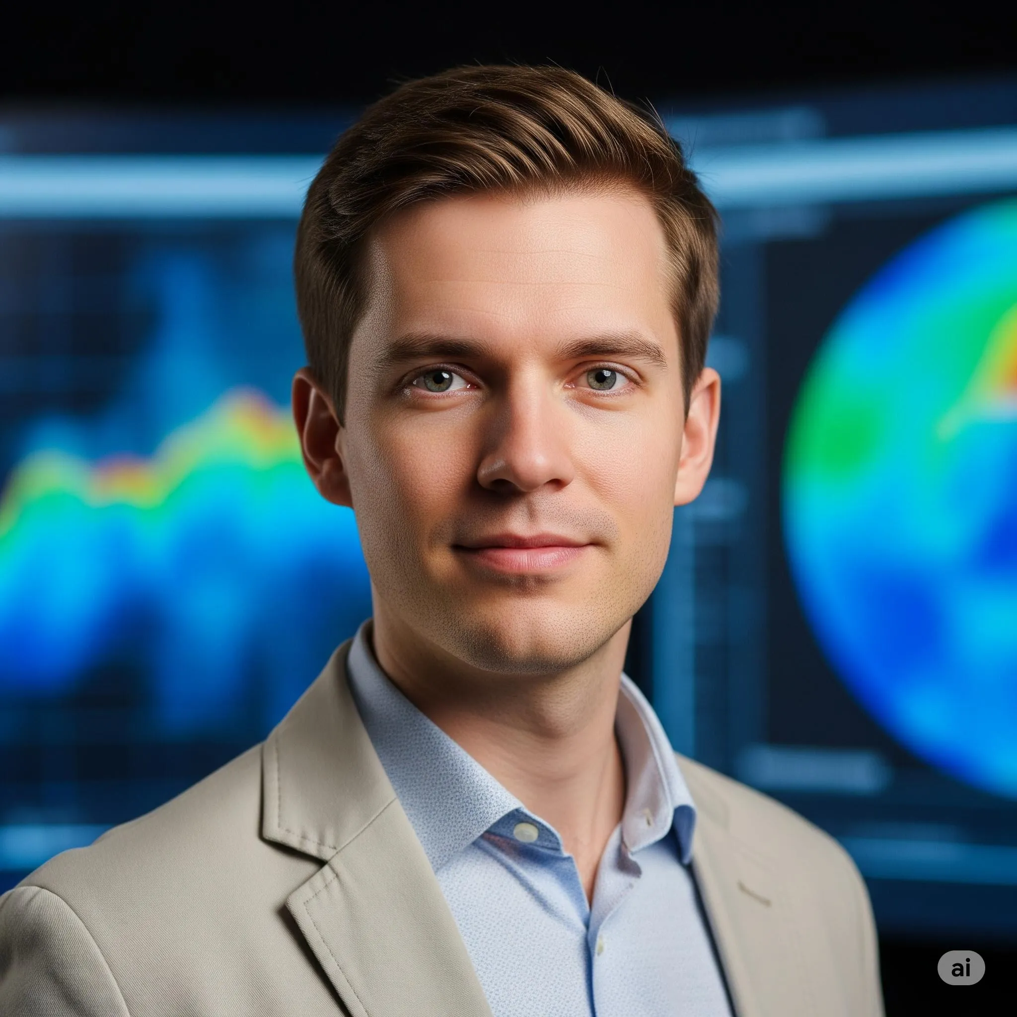
In my free time, I enjoy practicing mindfulness, which helps me maintain focus and clarity in complex situations.

Public links

Twitter: Nexier_Mentor_Dr.Dohyun.Ryu LinkedIn: Nexier_Mentor_Dr.Dohyun.Ryu Facebook: Nexier_Mentor_Dr.Dohyun.Ryu YouTube: Nexier_Mentor_Dr.Dohyun.Ryu TikTok: Nexier_Mentor_Dr.Dohyun.Ryu Instagram: Nexier_Mentor_Dr.Dohyun.Ryu

Adaptive access

The "Engage: Dr. Ryu" bot on the Nexier profile provides immediate, expert guidance on Areas of Expertise: Advanced GIS, Computer Vision for Satellite Imagery, Data Fusion, Python Programming for Geospatial Analysis, Project Management, Leadership in Geospatial Intelligence., anytime, 24/7.

Nearby minds

Related academics

Paired academic

Continue with Prof. Dr. Layla Al-Dossari

AI Super Professor · same program, complementary guidance.

View profile